
The Delaware-Hudson Land Surveyors Association (DHLSA) is a Membership Organization whose purpose is to promote the common interests and welfare of Land Surveyors within Orange, Rockland and Sullivan Counties of New York State. DHLSA strives to encourage professional ethics and sound surveying practices; to promote public awareness of professional land surveyors and their work; and to mentor the next generation of surveyors.


What is a Land Surveyor?
A Land Surveyor is a design professional licensed and regulated by the State of New York, who, through a combination of education and experience, understands and is able to delineate the physical characteristics of land, and is also qualified to perform and depict a physical retracement of the record boundary lines of that land.

A New York Licensed Land Surveyor uses applied mathematics and other technical and research skills to measure and plot: the dimensions of any portion of the Earth's surface, natural and man-made structures, the lengths and directions of boundary lines, and the contour of the Earth's surface.
Land Surveyors are also knowledgeable regarding zoning regulations, planning regulations, wetland regulations and general land use requirements.
Land Surveyors may offer a variety of services including:
Boundary surveys, proposed plot plans, building location and foundation location surveys, topographic surveys, subdivision design and platting, global positioning system surveys, unmanned aerial vehicle (UAV) and drone surveys, geodetic control surveys, wetland delineation, land development plans, percolation and soil testing, construction staking, monitoring of structural settling of buildings and other structures, utility and pipeline surveys.
According to New York State Law, only surveys made by licensed and registered New York State Land Surveyors are legal.
Only registered Land Surveyors have the combination of Land Surveying education and experience required for licensure in New York State, and only licensed and registered Land Surveyors have passed the three part examination required for licensure in New York State (said exam consisting of two national examinations totaling 14 hours, and a two-hour New York State specific examination).
Professional Engineers, Architects, Landscape Architects, Lawyers, real estate agents, contractors, and title company agents are not allowed to make boundary line determinations.
Also, a visual inspection of a property by a landowner, real estate agent, contractor, or title company representative is not enough to determine the legal boundary of that property. ONLY LICENSED LAND SURVEYORS MAY MAKE BOUNDARY LINE DETERMINATIONS IN THE STATE OF NEW YORK.

WHEN SHOULD A HOMEOWNER / LANDOWNER CONTACT A SURVEYOR?

You Should Contact a Surveyor When Buying Property Because:
Only a map of the survey made by a Licensed Land Surveyor can define what you've purchased. A Surveyor will show whether other people are entitled to partial use of your property through easements for utilities or rights-of-way. A Surveyor will determine whether fences, trees, buildings, building overhangs, gardens, driveways, sidewalks, swimming pools, house additions, and other property improvements actually lie on your property.
A Surveyor will determine whether your deed accurately describes the property you occupy. A Surveyor can provide an updated deed description for the property you are purchasing. This will allow you (or your Lawyer) to file your deed in the County Clerk's Office, thereby registering the transaction and preserving your property rights in the future.
Since a survey provided by the seller may be old, it may not reflect changes to the property or its boundaries. A survey protects you by bringing potential legal problems to your attention so you can address them before you make your purchase. A Surveyor can mark the corners of your property with permanent monuments so you will always be aware of your legal property lines.
You Should Contact a Surveyor When Refinancing Your Home or Applying for a Mortgage Because:
A bank or trust company will usually require a survey before lending money. Zoning, Planning, or Building laws may have changed since you purchased your home.
You Should Contact a Surveyor Before Building Additions to Your House or Permanent Improvements to Your Property (like fences) Because:
You want to make sure you are building on your own property. Mistakenly building on a neighbor's property can cause legal problems and extra construction costs. A Surveyor can stake-out, or mark the location of proposed buildings so that you are sure they are on your property and meet all local setback requirements and zoning restrictions. In case of a dispute, your Surveyor can act as an expert witness, and will assume professional responsibility for your survey in court.
You Should Contact a Surveyor When Subdividing Property or Selling Individual Lots Because:
Your Surveyor will survey the site and draft a proposed subdivision plan. Your Surveyor will check and note planning restrictions, easements, and other legalities for your subdivision (for example: wetland delineation and mapping issues, minimum lot sizes and setbacks, etc...). Your Surveyor can recommend or engage other consultants to carry out preliminary studies, Engineering, planning, and environmental issues to submit with the draft subdivision plan - and ensure compliance with local, state, and federal laws. Your Surveyor can represent you and your project at Planning, Building, Zoning and Town & County Board meetings, if required. Your Surveyor will prepare final subdivision plans. Retaining a Surveyor will give your buyers and clients confidence in the purchase of your property, or one of the lots in your subdivision. Consulting a Surveyor may help simplify the Land Development Process, and a Surveyor will be able to make recommendations as to the feasibility of projects.

Contacting a Land Surveyor
You can choose a Surveyor based on prior recommendations, or you can consult your local Yellow Pages under the heading Land Surveyors.
You should make your needs known to the Surveyor as clearly as possible and as soon as possible. Be sure the Surveyor knows why you want the survey made, and exactly which services you require. This will ensure that the fee estimate the Surveyor gives you is accurate.
Don't be afraid to ask questions if you are unsure of any aspect of what is required, and feel free to ask the Surveyor for suggestions as to how best to proceed with your project.
You should supply copies of any survey maps, deeds, records of title, or any other pertinent information about your property to the Surveyor at your first meeting (if possible).
The Survey:
As soon as the you have agreed on the scope of work and services to be provided by the Surveyor (which often involves a written contract), the Surveyor will schedule your property or project for a survey. The Land Surveyor will perform research through a variety of sources, including County Clerk's offices and other agencies, to gather information affecting the boundaries of the property, as well as reviewing the documents and maps you provide.
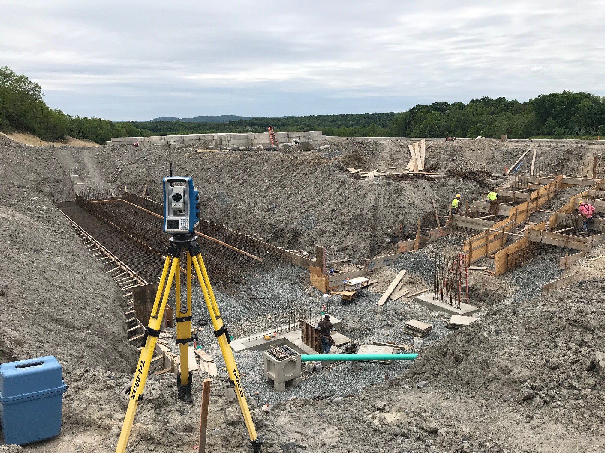
After this information has been gathered, the Surveyor will send a field crew (usually consisting of two or more Surveying Technicians and/or Surveyors) to perform a field survey of the property. These trained professionals will locate any physical evidence that may affect the property boundaries, as well as locate any physical improvements to the property. If engaged for the project, the Surveyor, Survey Crew, or other professionals may visit the site to perform various other tasks like wetland delineation, percolation testing, and general site reconnaissance.
After performing the field survey, the Surveyor will make a determination of the property lines based on research and field evidence. Using this information a map, or plat, will be drafted for the parcel.
How Much Will a Survey Cost?
The cost of a survey will depend on the size and location of the property, and the actual services to be provided by the Land Surveyor. Such items as the complexity of the descriptions, terrain and the shape of the property are factors that must be considered.
As a result, only a Land Surveyor (not a bank, Lawyer, or contractor) can accurately estimate the cost of a survey. Surveyors are willing to discuss their fees and offer an estimate before you authorize a survey.
The cost of a survey is only a small percentage of the cost of buying, refinancing, or subdividing property. The protection and piece-of-mind a survey affords is well worth the cost.